
What can the Mala GPS app do
Step 3 of 5 — Getting started guide
What can the Mala GPS app do?
You've probably guessed that the Mala GPS app is about more than just a single dot on the map showing your tracker's location. 🛰️
That's why we've put together a few tips that will genuinely make your life easier! 🤗
Features in the Premium subscription
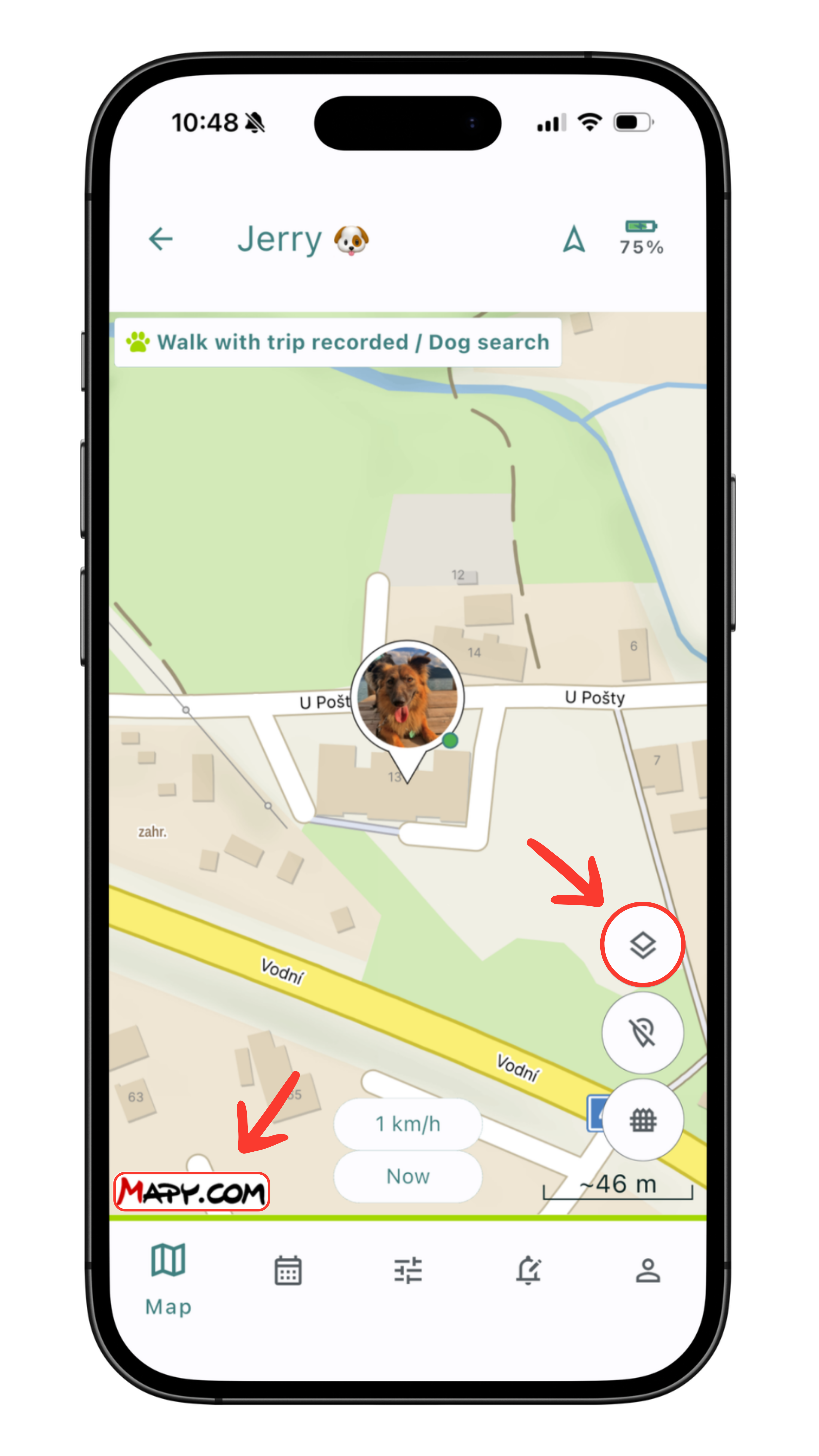
Map data from Mapy.com 🏆
With a Premium subscription, you can choose between maps from Google or Mapy.com.
Mapy.com (by Seznam.cz, formerly Mapy.cz) is a popular Czech mapping service known for its detailed hiking and outdoor maps. It offers excellent coverage of hiking, cycling, and cross-country ski trails, including KČT trail markings and contour lines. It's strongest in the Czech Republic and Central Europe, making it a great companion for tracking your pet or a loved one even outside the city.
We've made the full range of Mapy.com map data available to you:
- Basic - a clear map for everyday use. It shows streets, buildings, addresses, and important points both in the city and beyond. Ideal when you want to quickly check where your tracker currently is.
- Hiking - a detailed outdoor map with KČT trail markings, cycling routes, and contour lines. A perfect choice when you're heading into the woods, the mountains, or off the beaten path with your dog or a loved one.
- Winter - a special layer for the winter season showing cross-country ski trails, downhill slopes, and ski resorts. Useful if you want to keep track of movement in the mountains during the winter months.
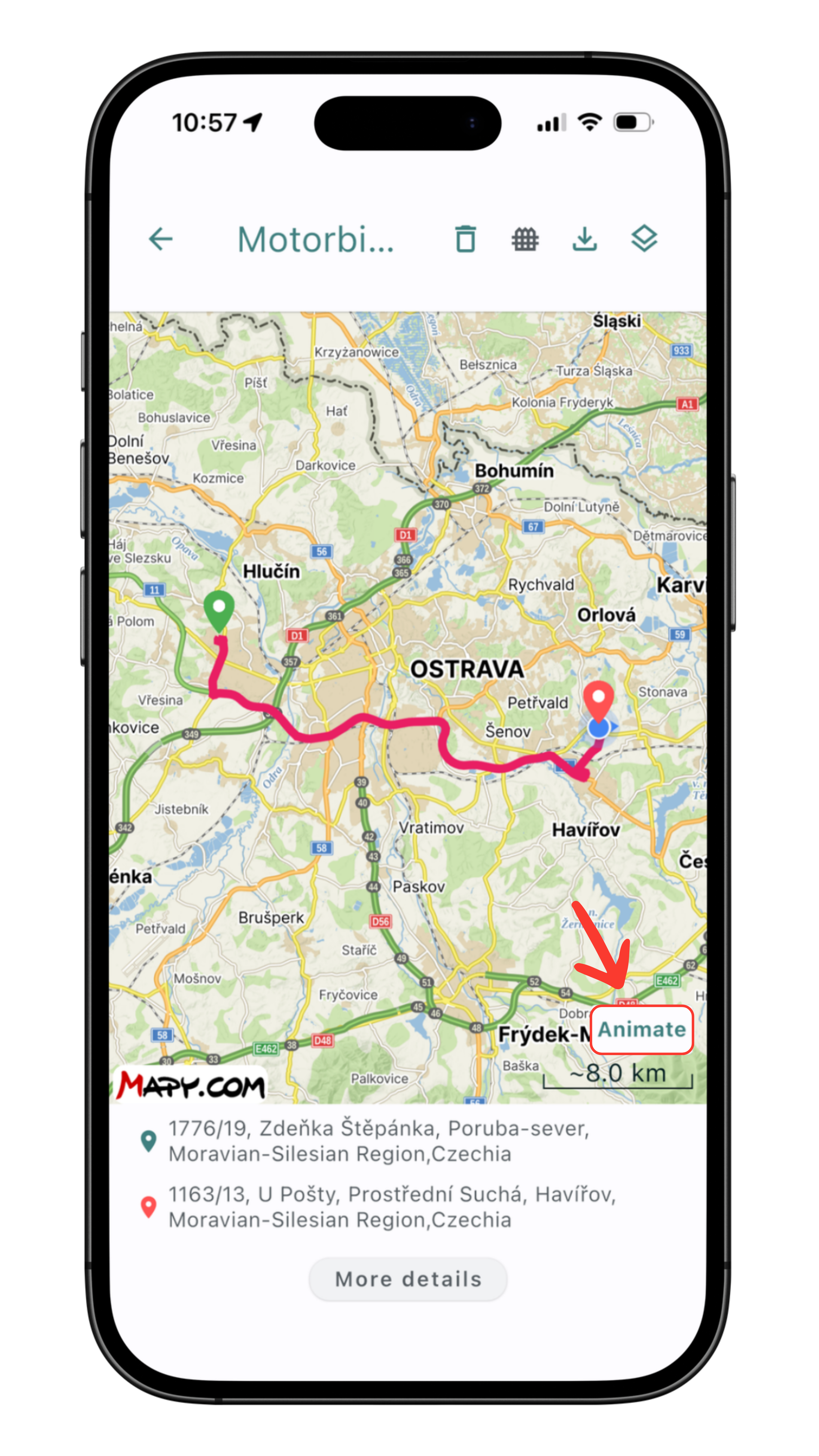
Animated route player
Route animations are a very popular feature available with a Premium subscription. You can look back at your journey as an animation based on the recorded positions. The player appears in the route history once you open a route's details.
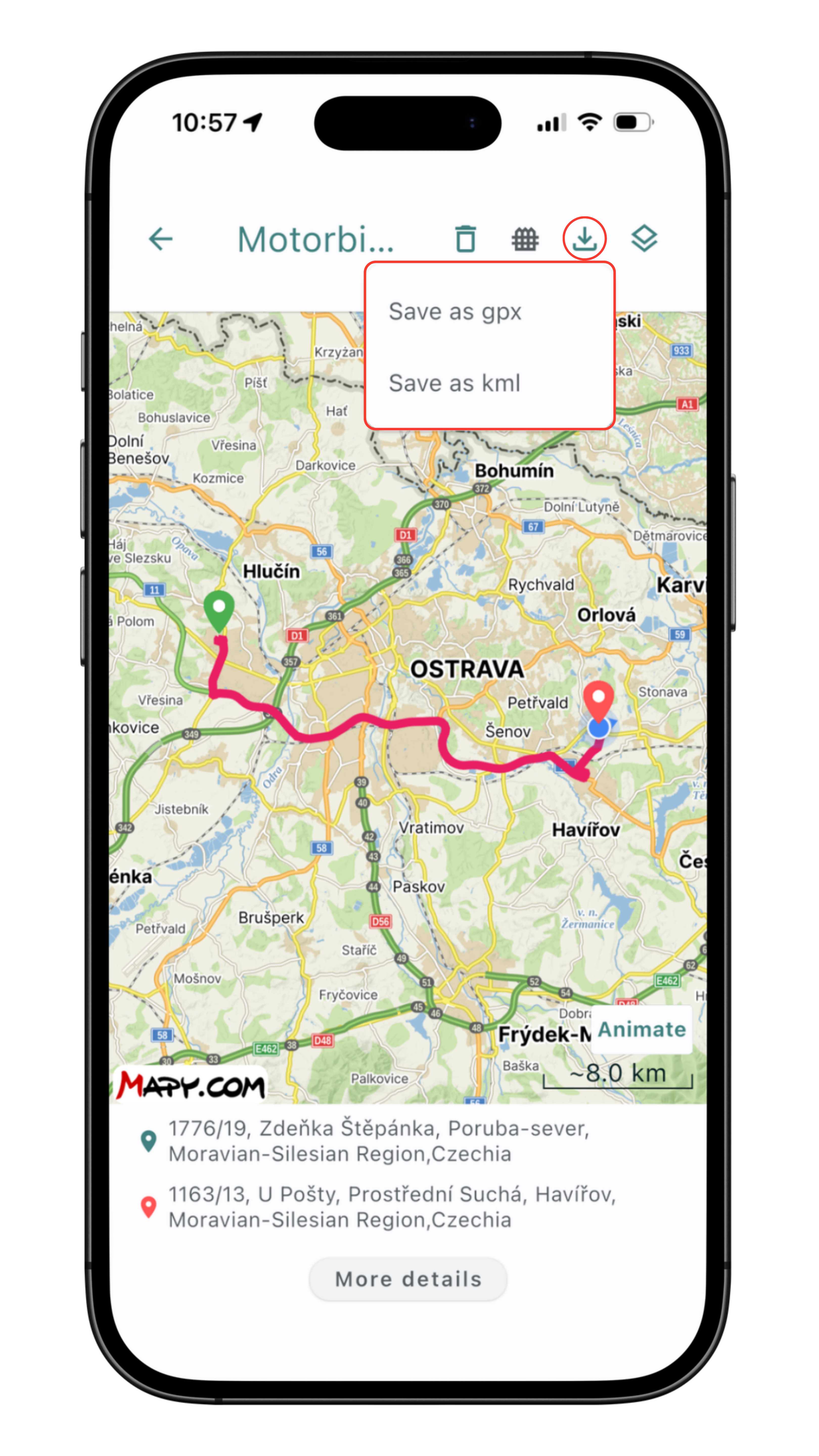
Route exports to GPX and KML
A neat feature for enthusiasts who want to download their route data and import it into a third-party app.
Map
By default, we use Google Maps as the map data. You can choose between the classic, satellite, or hybrid map. With a Premium subscription, three Mapy.com variants are added on top — six map types in total.
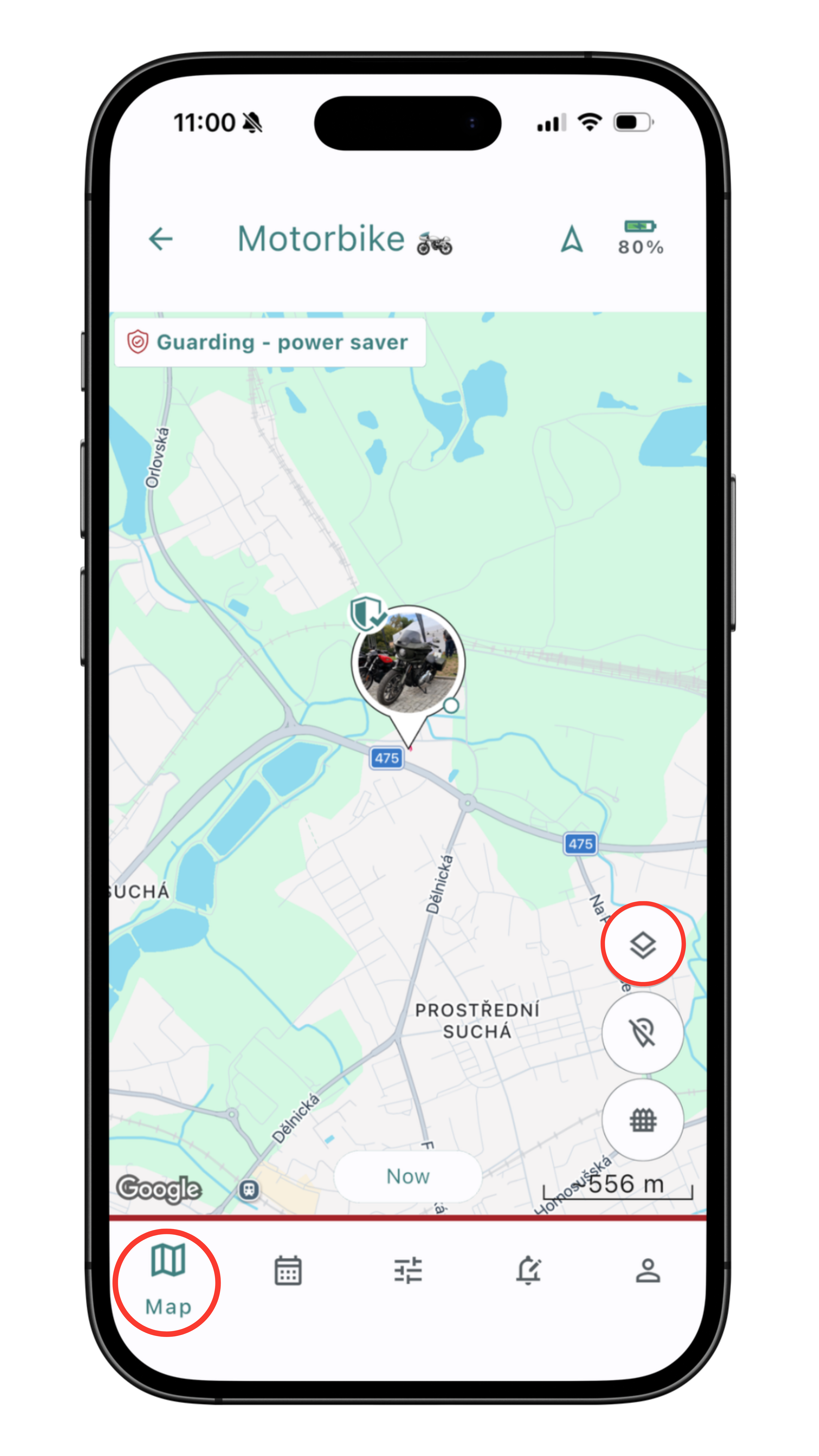
Choosing map data
You'll find your preferred map data option on the Map tab, in the app's bottom menu.
You'll then find the map data options in the menu on the right side of the screen. 🗺️
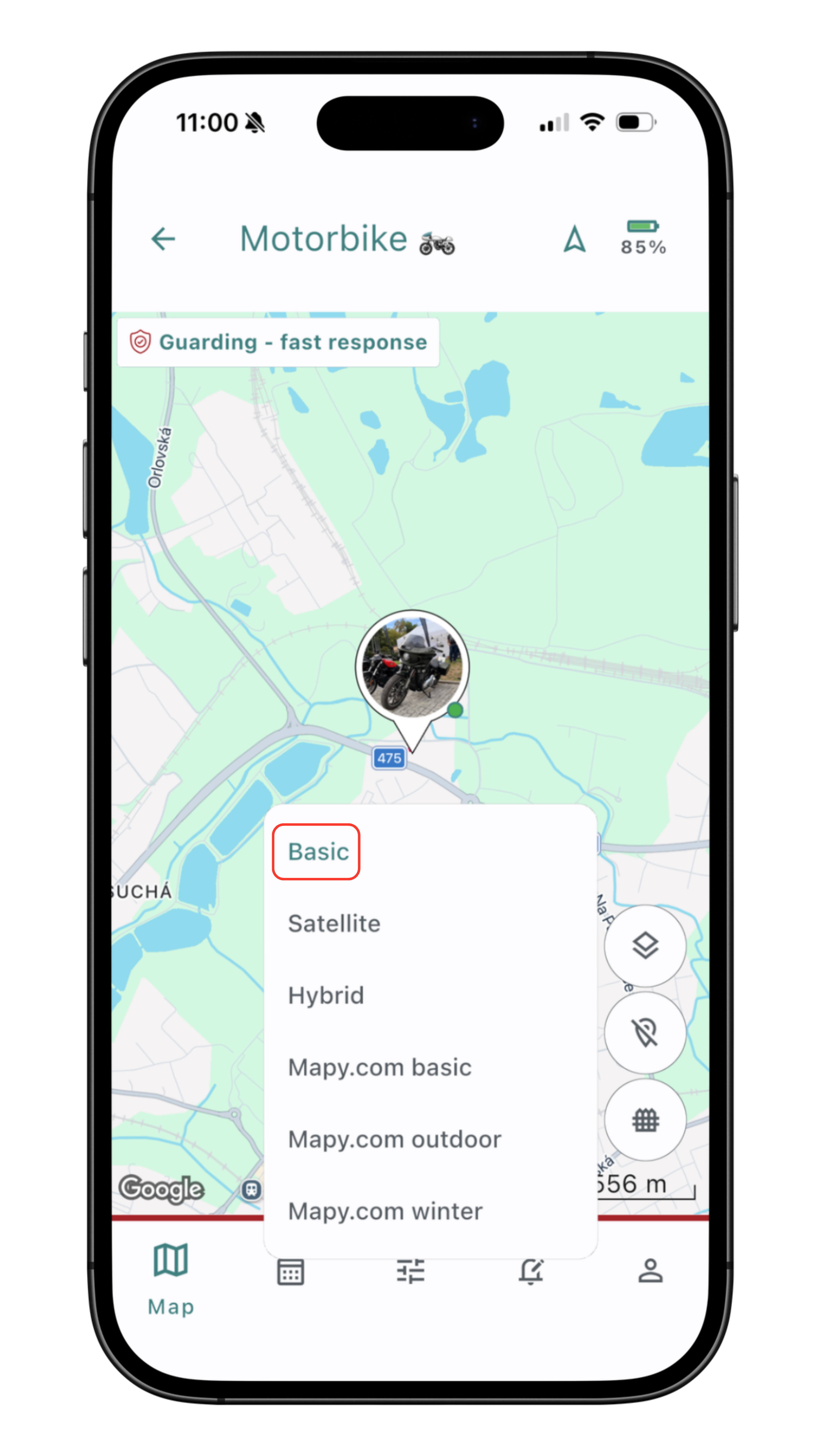
Classic map
The clearest and most commonly used option for everyday use. 🗺️
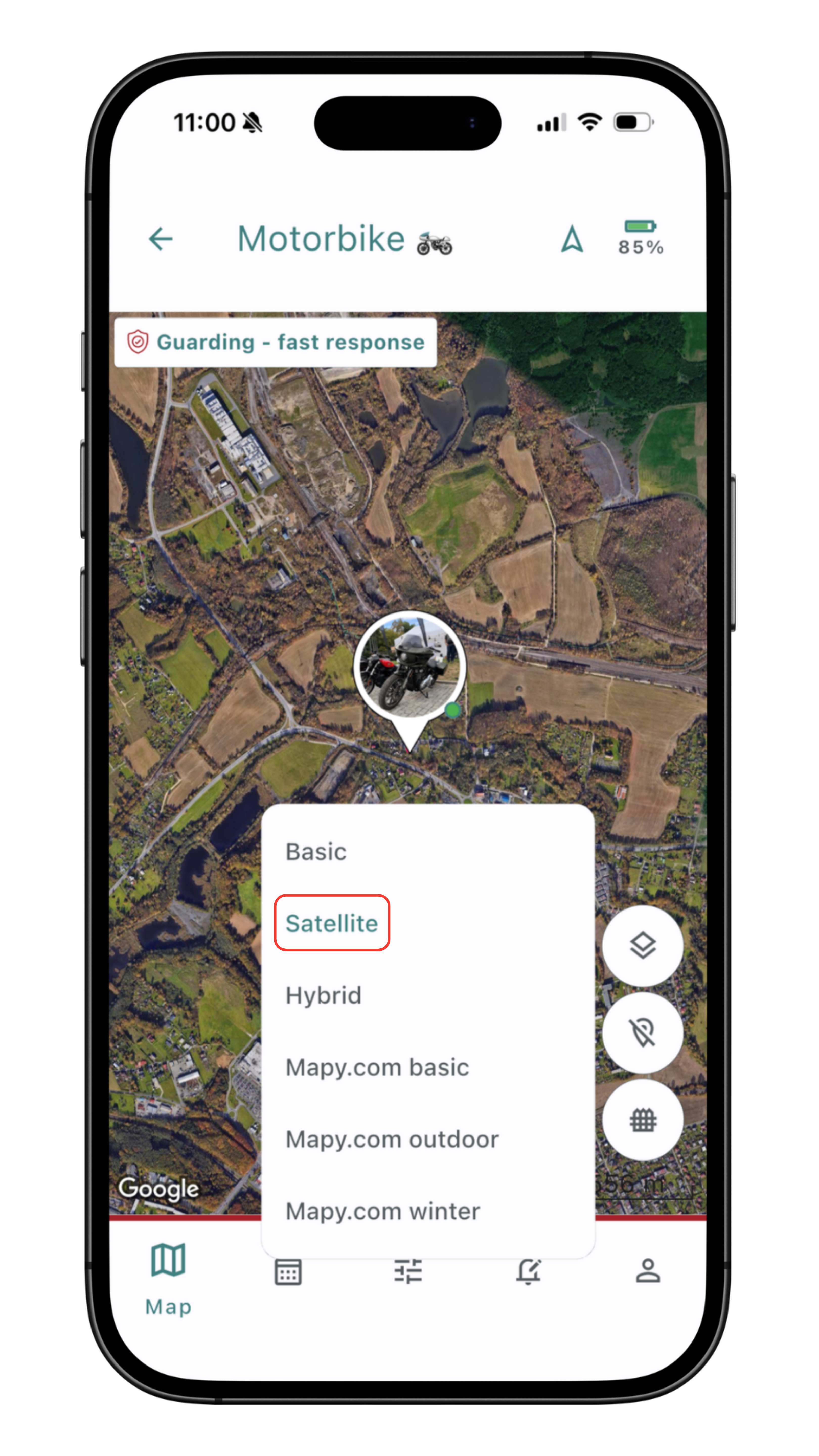
Satellite map
Shows the map from a "bird's-eye view" 🦅, for better orientation in the terrain and in denser urban areas.
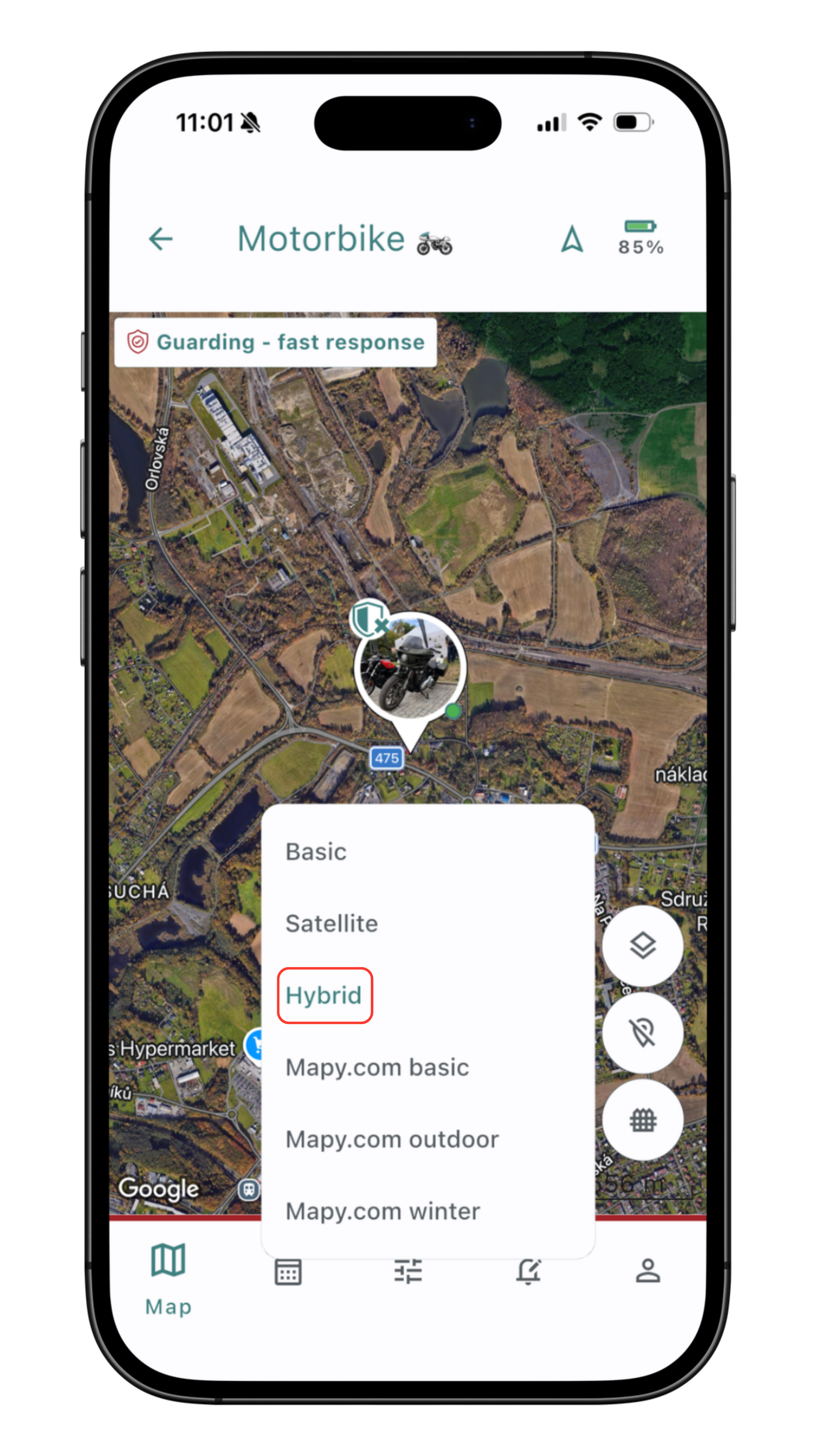
Hybrid map
Based on the satellite map, but it also includes street names, points of interest, and landmarks. 🤓
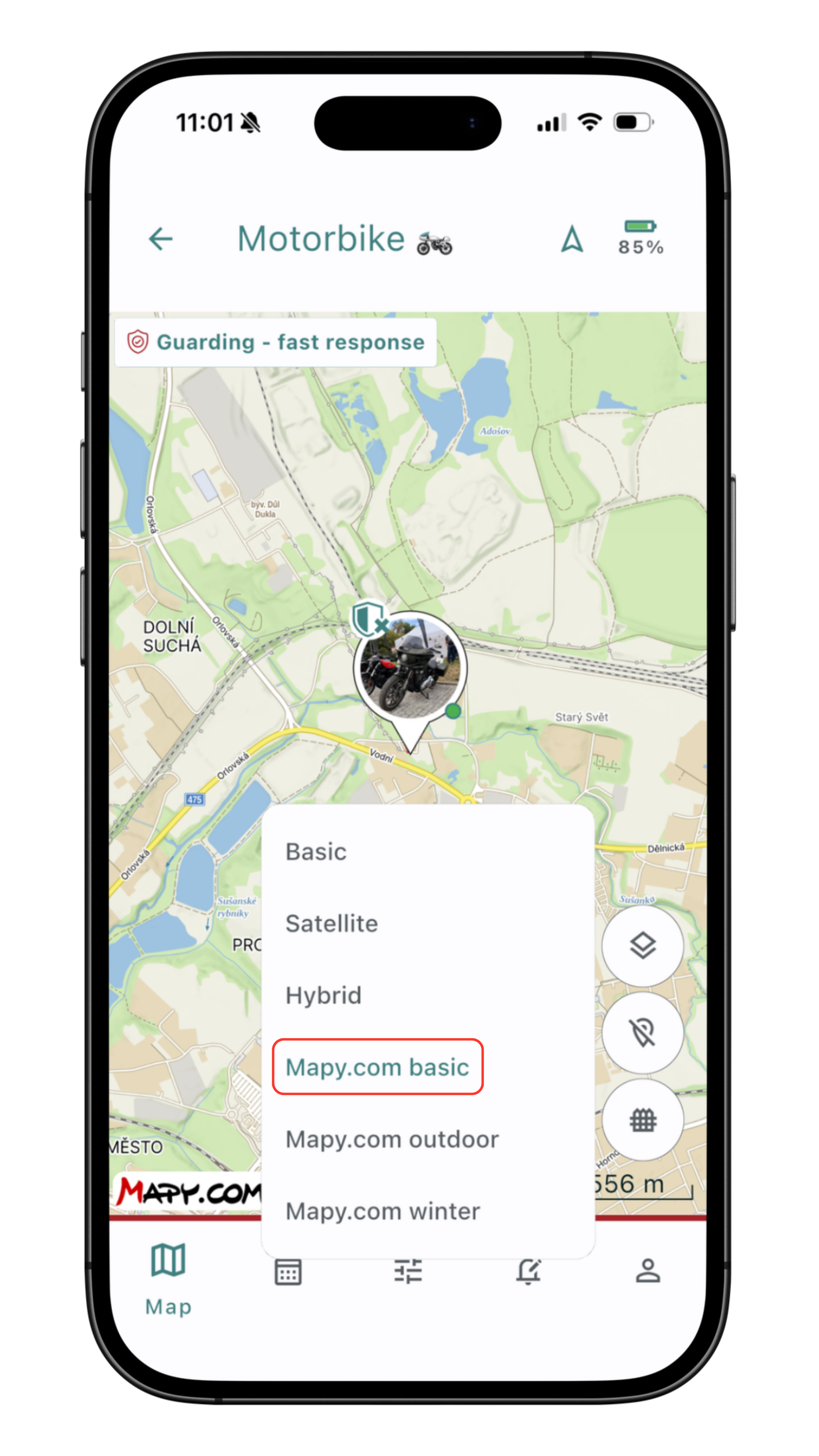
Mapy.com basic
Premium. A clear map for everyday use — streets, buildings, addresses, and important points. 🗺️
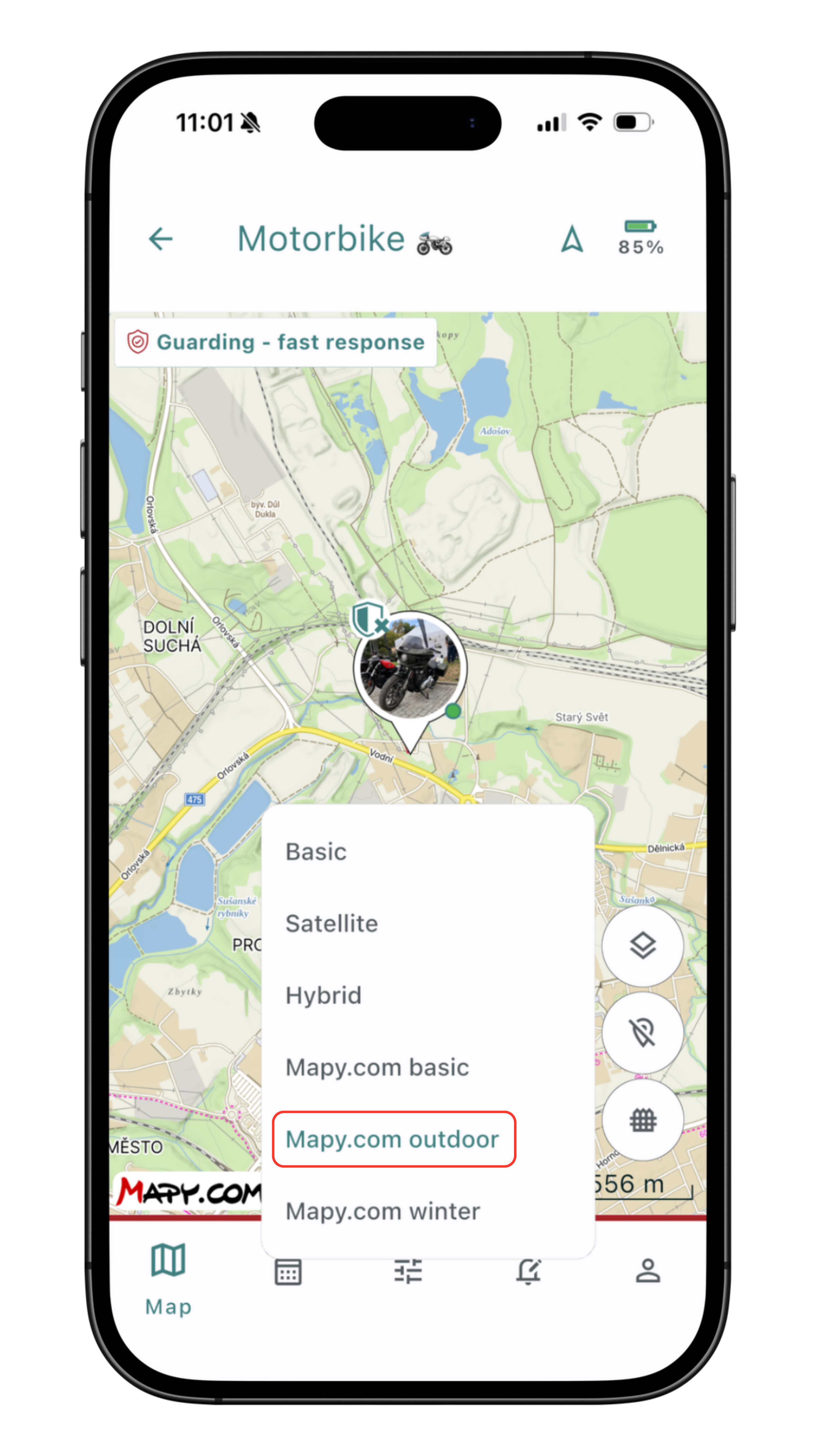
Mapy.com hiking
Premium. A detailed outdoor map with KČT trail markings, cycling routes, and contour lines. 🥾
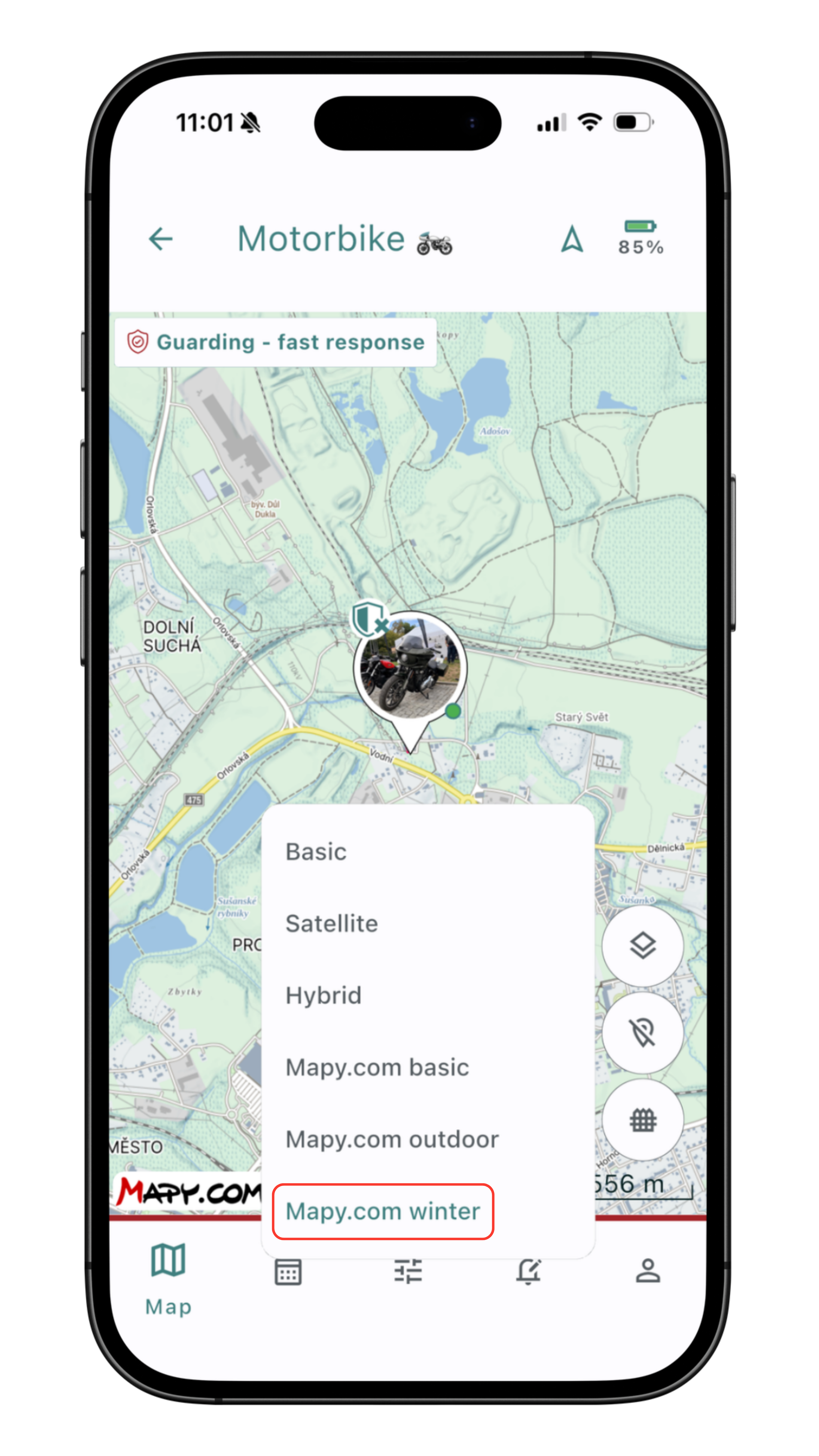
Mapy.com winter
Premium. Cross-country ski trails, downhill slopes, and ski resorts. ⛷️
Route history
Movement history isn't just for athletes. An overview of the distance you've walked, run, or driven interests everyone, which is why we all like to check in the evening how we did. Working with the overviews in the history is very simple and clear. 🗺️
NOTE: Routes from modes such as Walk / Bike ride without trip recorded, and similar, are not saved to the history.
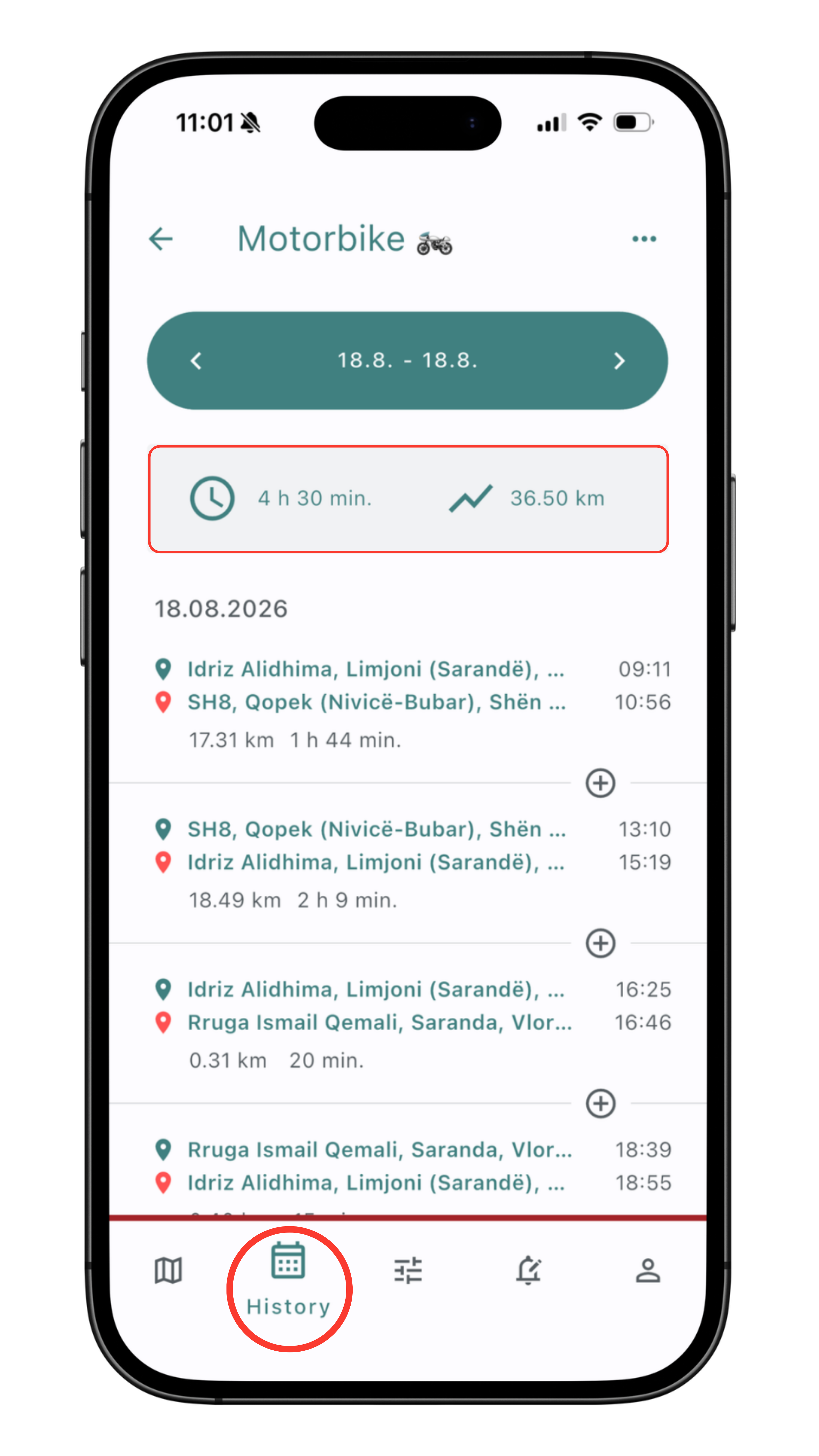
Movement history
You'll find your walked/travelled routes for browsing on the History tab in the app's bottom menu.
The current day is shown first, with all its records, along with how long Mala was moving and what distance it covered.
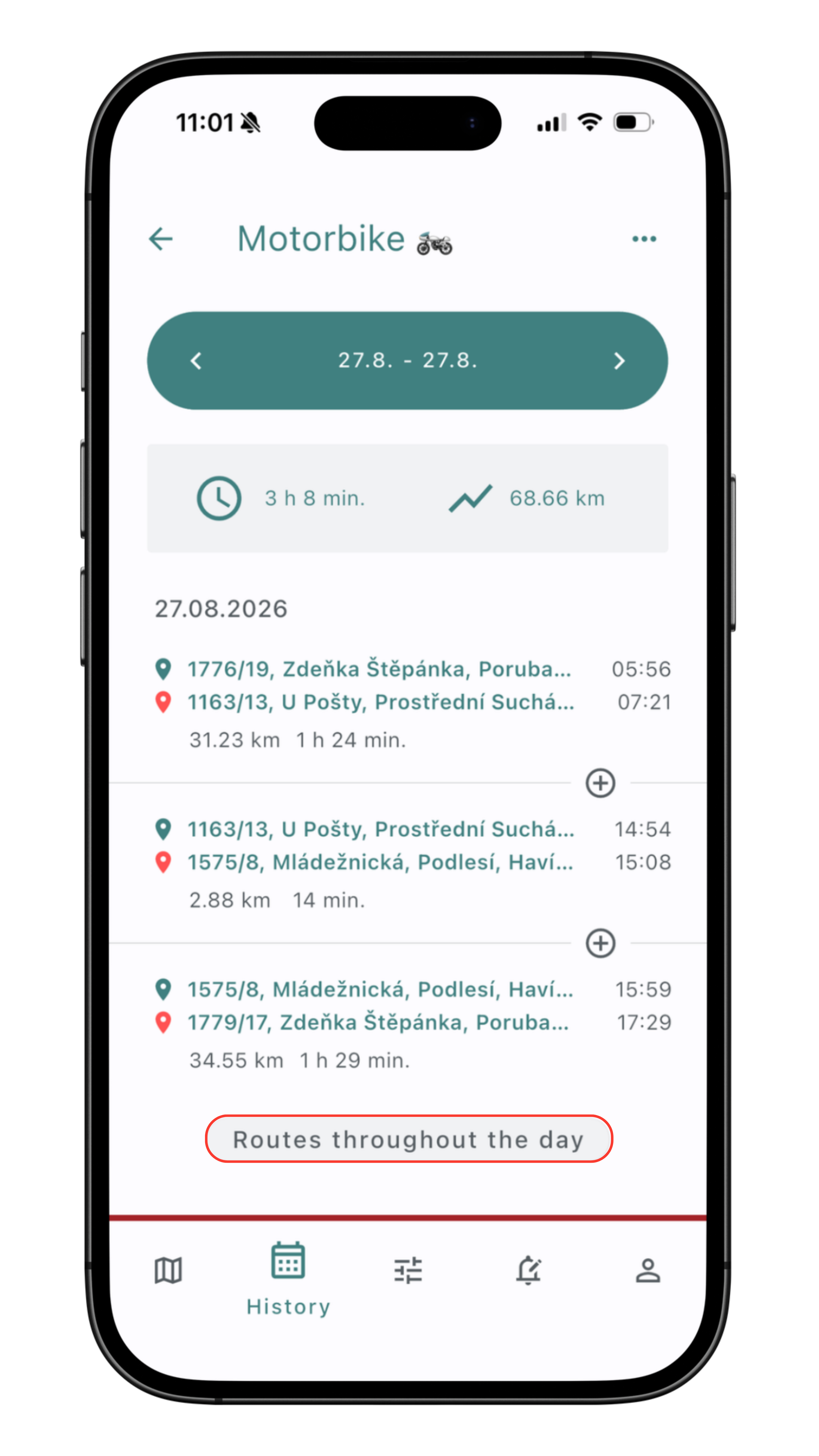
Detail of a single route and the whole day's route
A great, simple way to view all recorded routes on the map, giving you an overview of your movement.
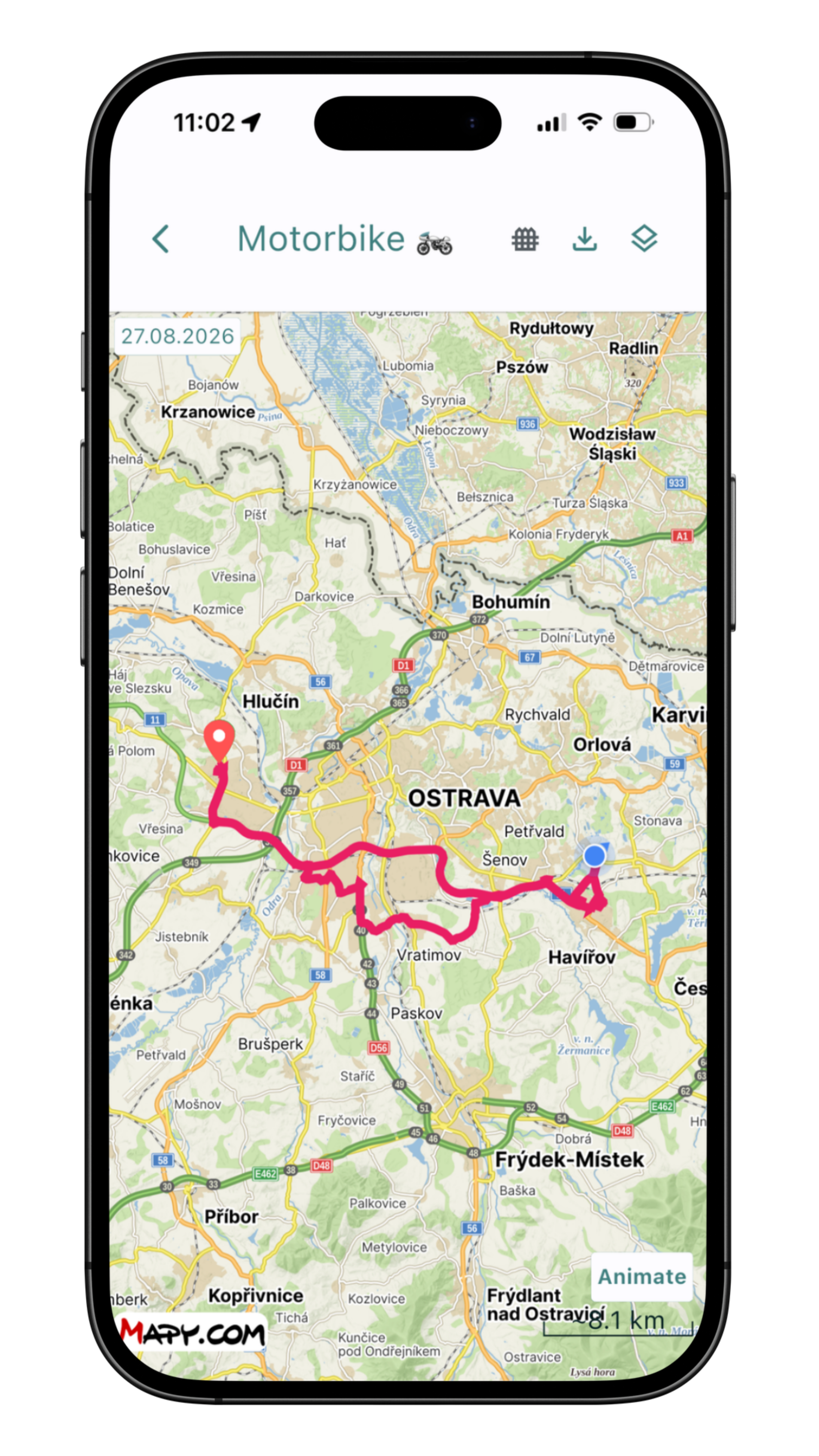
Whole day's routes on the map
On the map, you'll see all the routes recorded for that day.
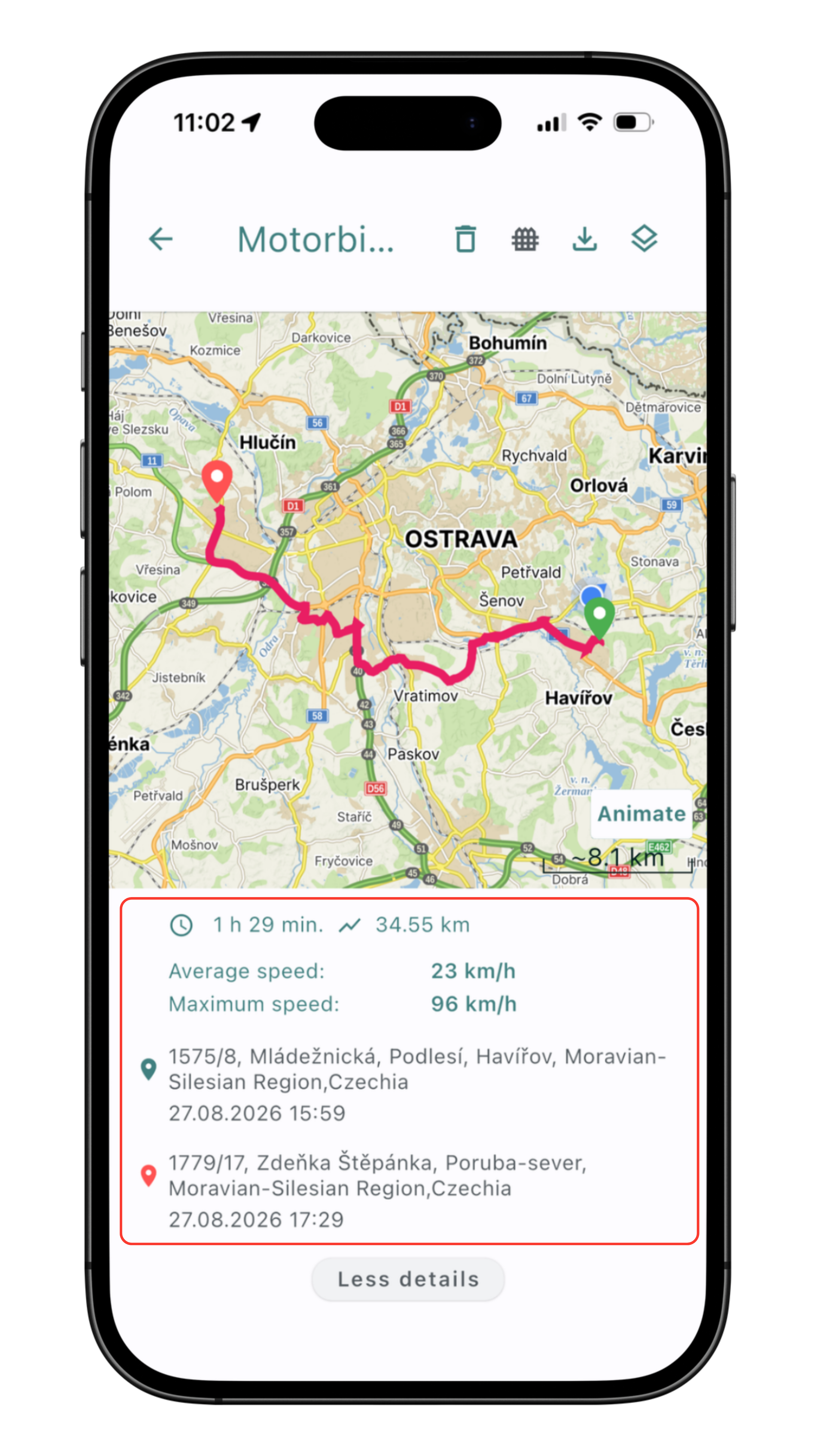
Detail of a single route on the map
Simply click on the route to open its details.
More detailed route information
The Mala GPS app also shows the average and maximum speed of movement.
Centering
To make it easier to keep track of the location and distance between your phone and Mala, the Mala GPS app offers flexible centering options.
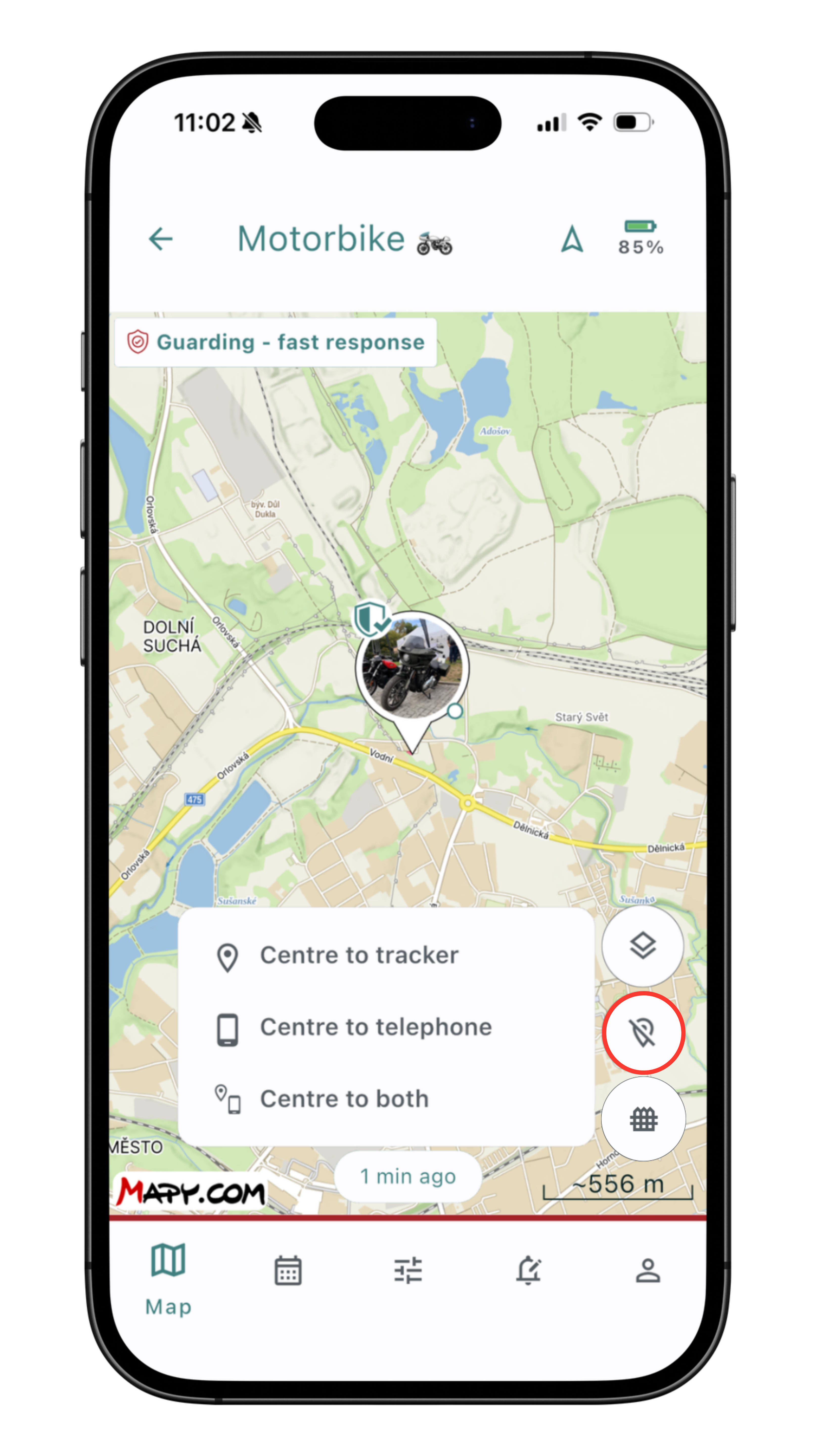
Choosing centering
You'll find the centering menu on the Map tab.
The centering option is then on the right side of the screen.
In the menu, you can choose from 3 centering options.
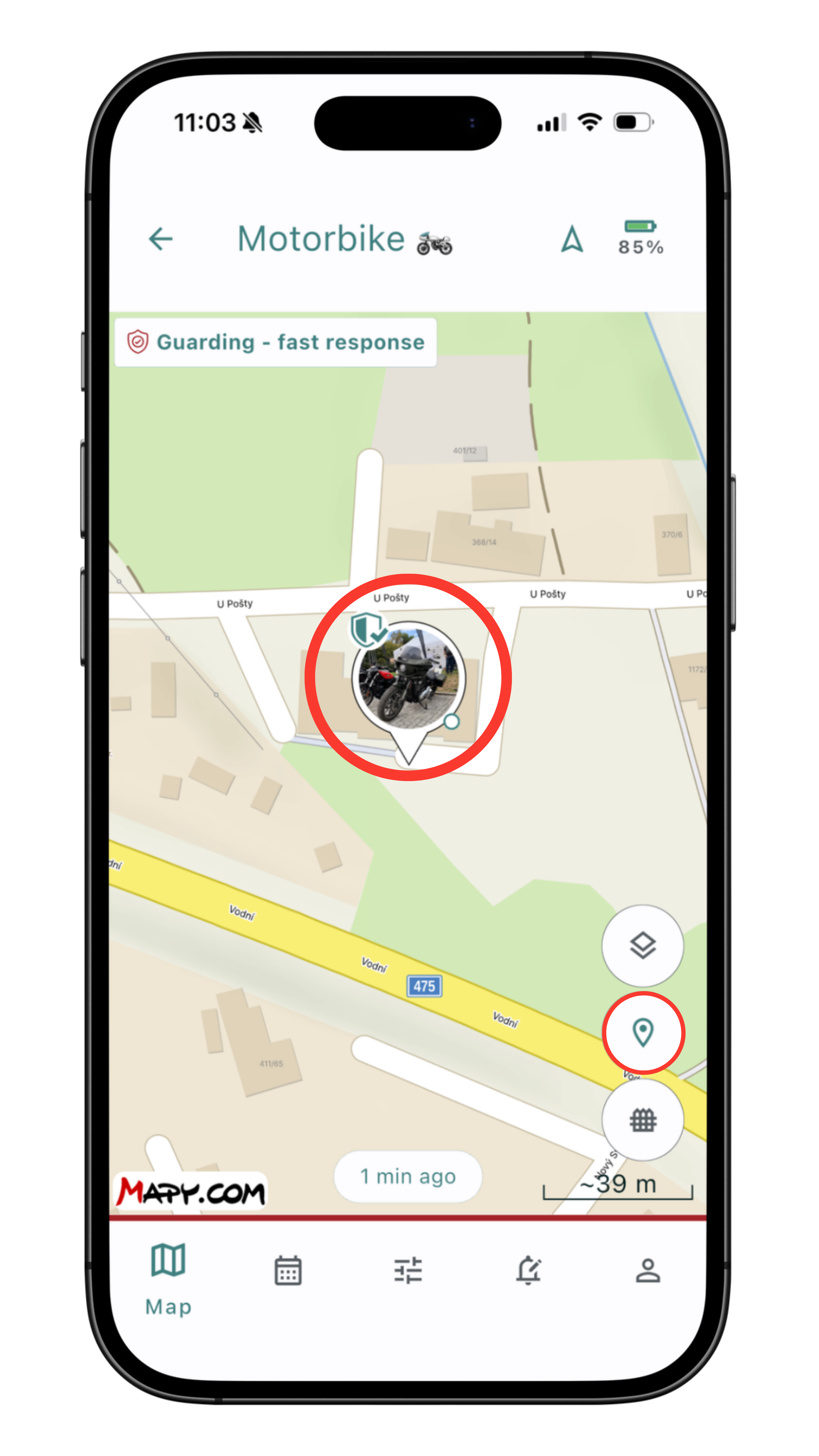
Center on the tracker 🛰️
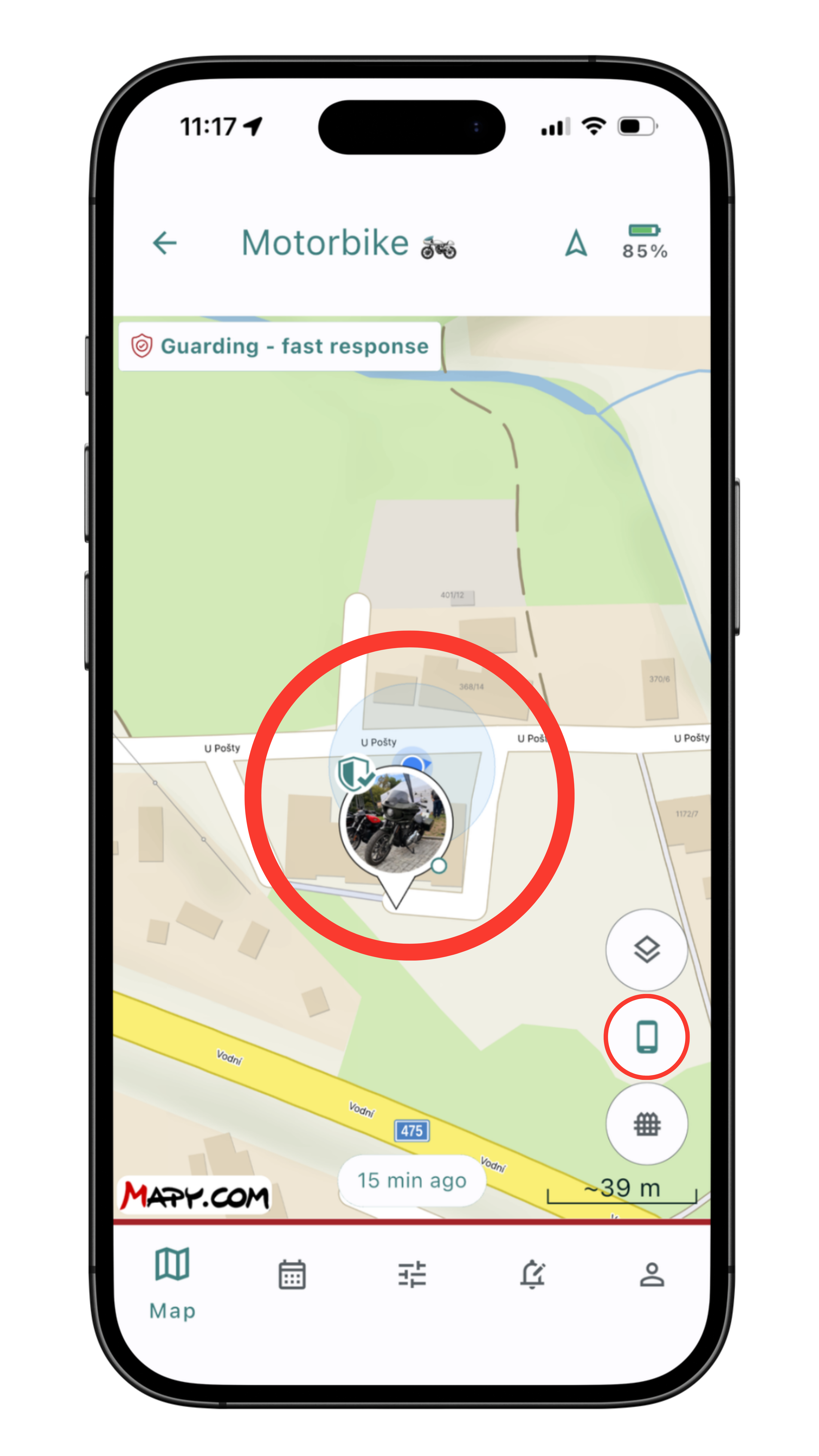
Center on the phone 📱
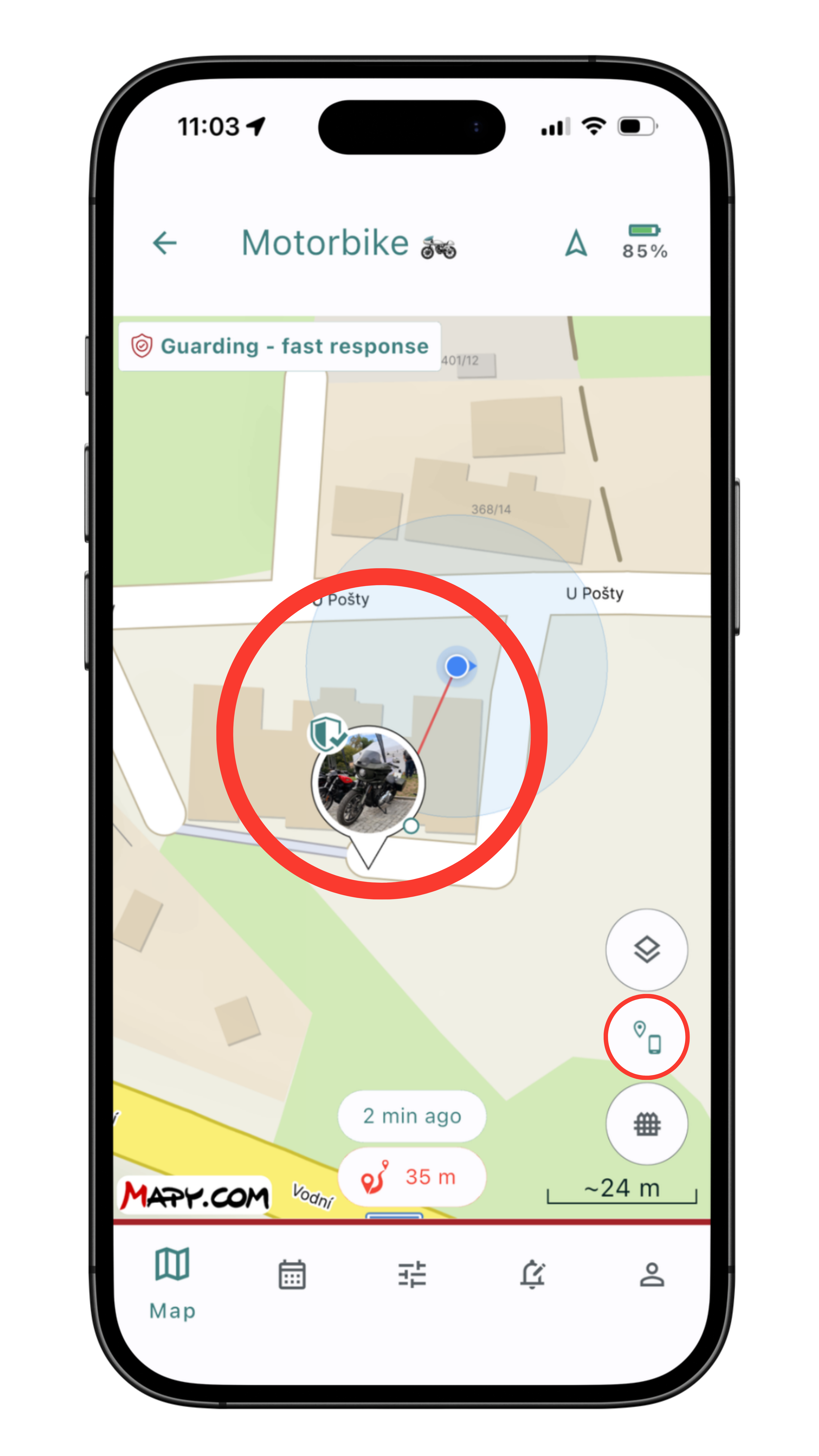
Center on both 📱🛰️
Notifications
The Mala GPS app lets you easily manage notifications — how it informs you on your phone or smartwatch. 📱⌚
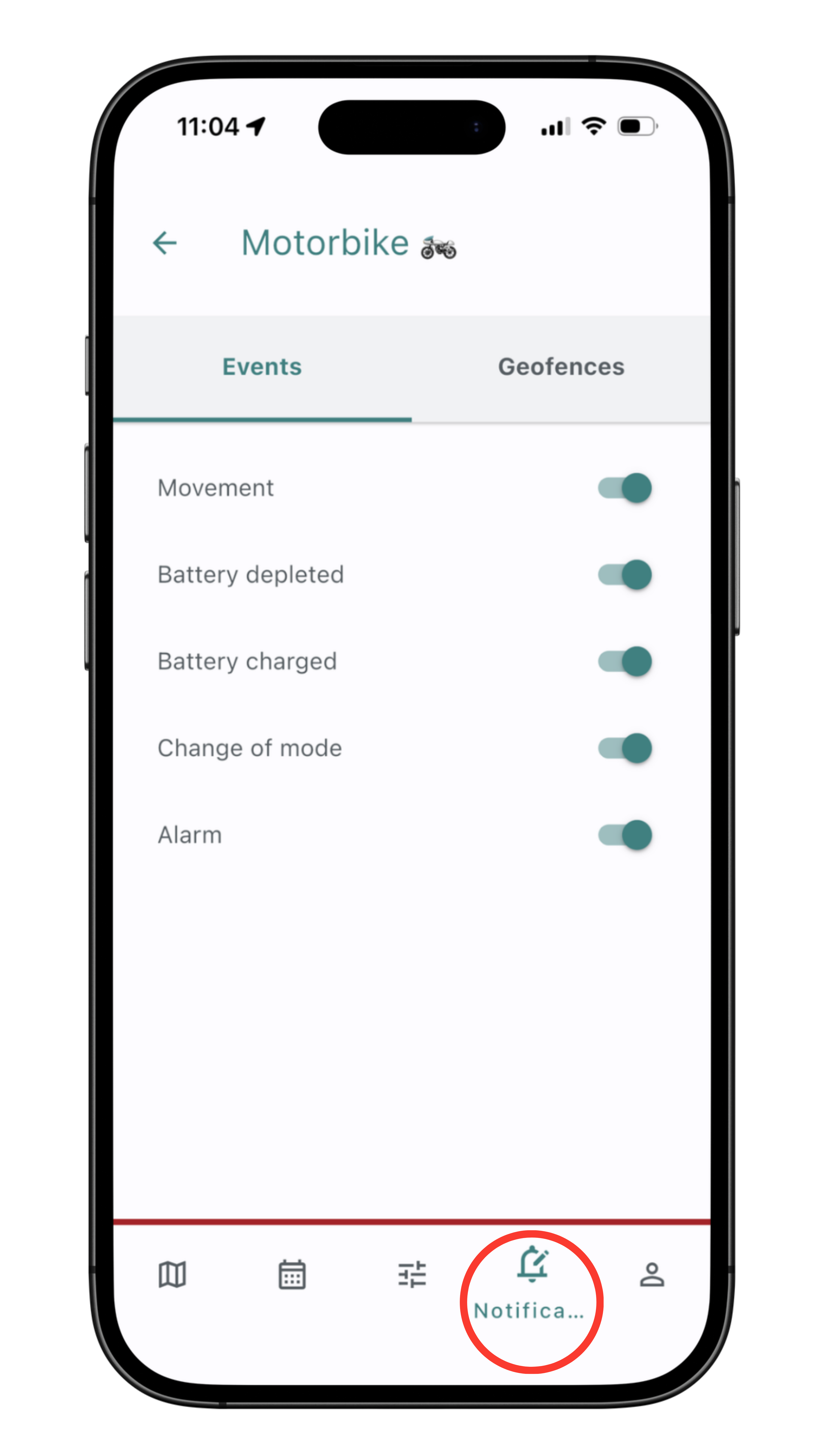
Basic notification settings
You can adjust the basic notification options to your preferences on the Notifications tab at the bottom of the menu. Here you can choose between Event and Geofence notifications.
- Event notifications
- Movement — a notification for when Mala starts and stops moving.
- Battery depleted / charged — we recommend keeping this on so the tracker doesn't run out of battery unintentionally. The first low-battery warning arrives at 20%, followed by another at 10%, so you have time to recharge the tracker. At 5% battery, you'll get a notification that the tracker is depleted.
- Mode change — this notification acts as a check, letting you confirm that the selected mode was actually set. It's also useful if the tracker is used by more than one person.
- Alarm — a notification tied to the guarding modes included in the Bike and Guarding asset profiles.
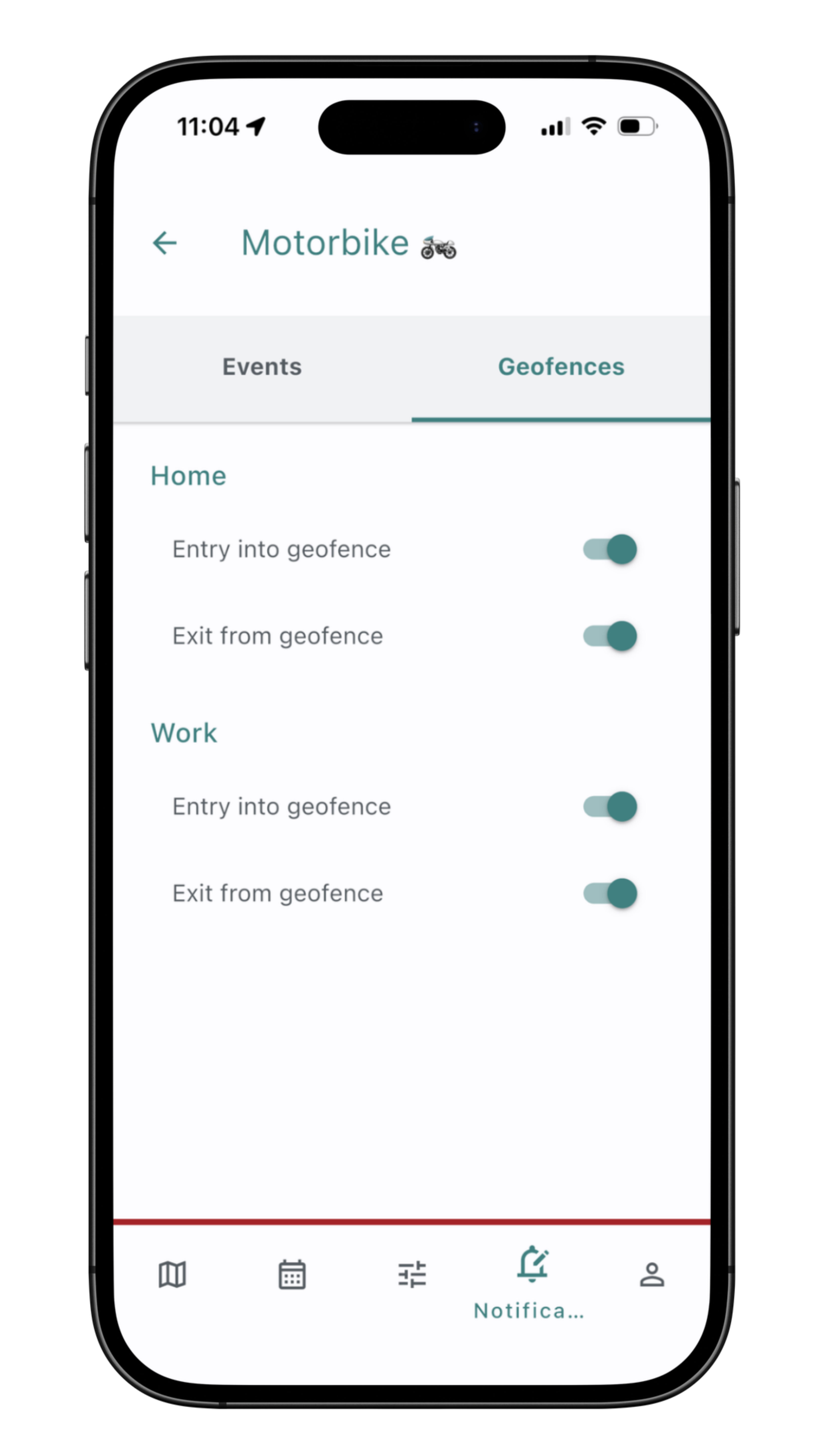
Notification settings for geofences
The basic geofence notification settings let you quickly adjust notifications for geofences you've already created. You can learn how to set up geofences in the next article.
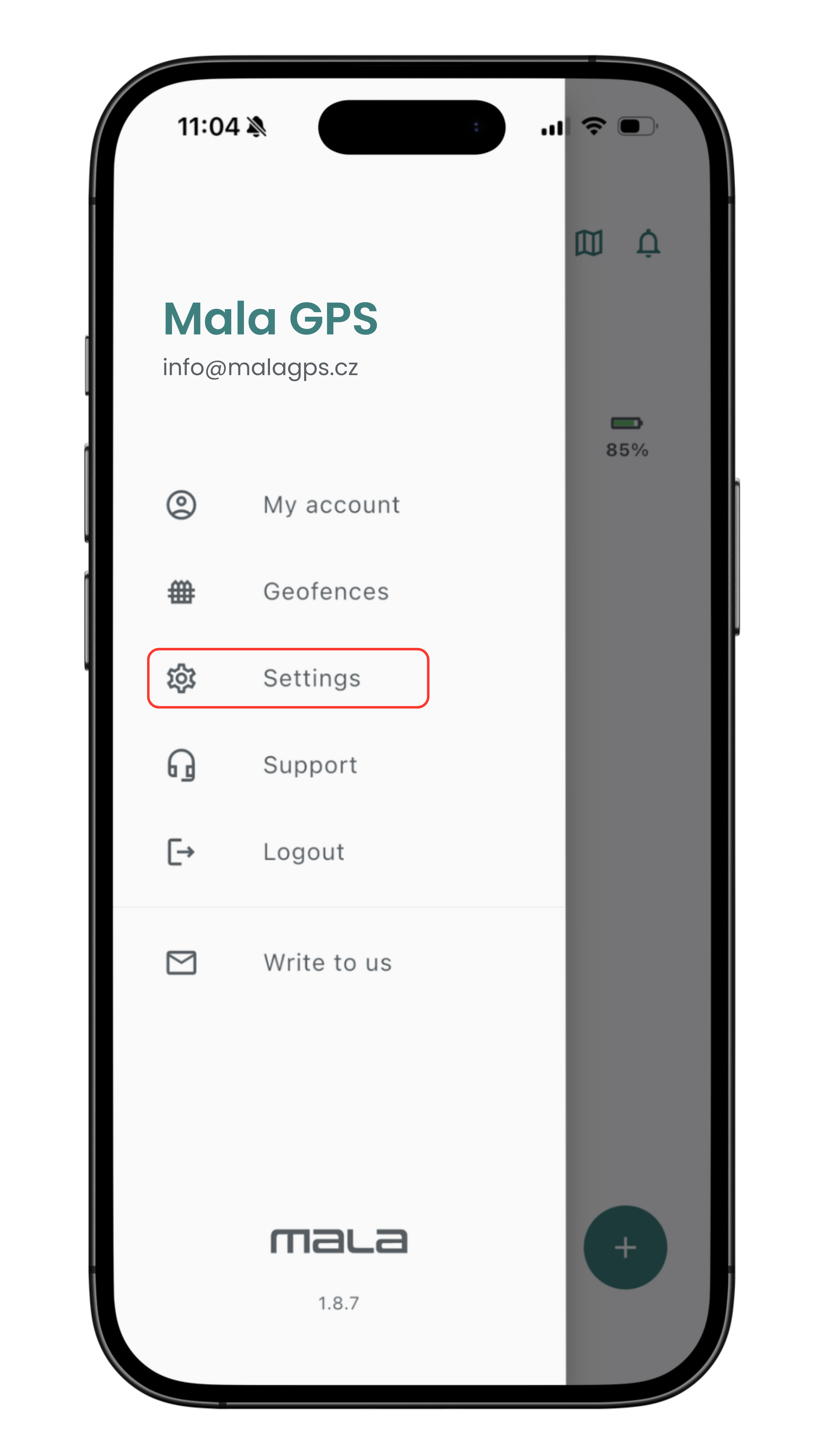
Notification and alarm sound settings
In the Notification settings section, you can also set the sound that accompanies notifications and alarms. If you want the Mala GPS app to alert you with sound, make sure the "Mute sound in foreground" option is left unchecked.
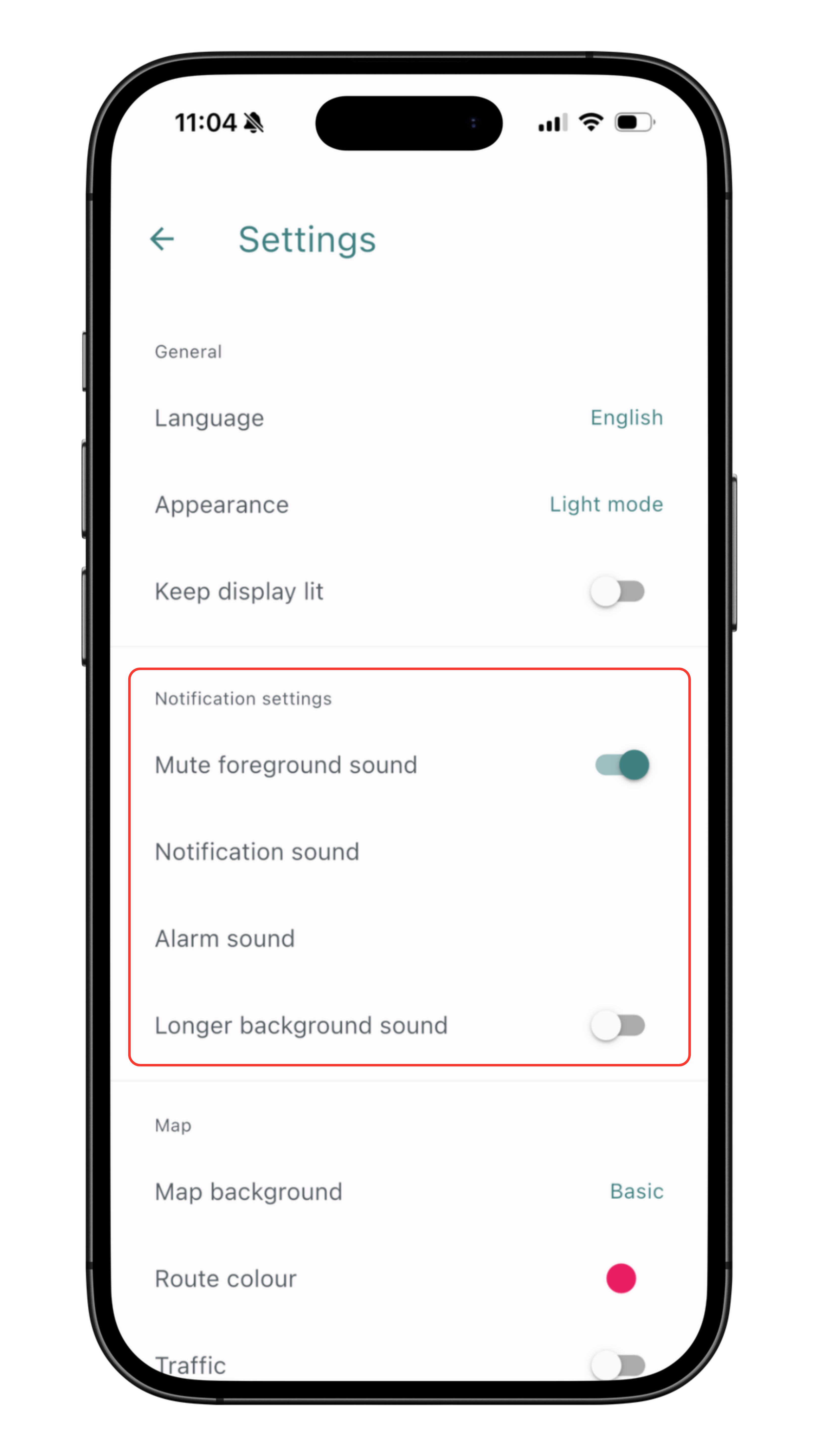
Notification settings, step 2
Adjust the settings to suit your needs so you have full control over your notifications.
❗️Tip for trouble-free notification display
📌 Summary — what to remember
- In the app, you can choose between the classic, satellite, and hybrid map from Google.
- The Premium subscription adds map data from Mapy.com (basic, hiking, winter).
- Route history shows distance, time spent moving, and average and maximum speed.
- Note — routes from modes without trip recording (such as Walk without trip recorded) are not saved to the history.
- The app can center the map on the tracker, on your phone, or on both at once.
- Notifications can be set up for movement, battery status, mode changes, alarms, and geofences.
❓ Frequently asked questions
- What maps does the Mala GPS app use?
- By default, Google Maps (classic, satellite, hybrid). With a Premium subscription, also Mapy.com in the hiking, winter, and basic variants.
- How do I view route history in the app?
- Tap the History tab in the app's bottom menu.
- Why wasn't my route saved to the history?
- Routes are only saved from modes with trip recording enabled. Modes such as Walk without trip recorded don't record any history.
- How do I set up notifications in the Mala GPS app?
- Tap the Notifications tab in the bottom menu. For notifications to work, you need to have notifications enabled for the Mala GPS app in your phone's settings (both iOS and Android).
- What is a geofence and how do I set one up?
- A geofence is an area on the map — you get a notification when it's crossed. You can set up alerts for entering and leaving the area separately. You'll find the settings in the app's menu. A detailed guide is available in the next article.
Step 3 of 5 — Getting started guide
Next article
Geofences — taking things to the next level
Have a question? We're here for you!

Email: info@malagps.cz
Address: U Pošty 1163/13, 735 64 Havířov – Prostřední Suchá, Czech Republic
Stay connected with us on social media too


